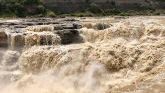
Huang He finally has an accurate birthday.
Chinese scientists such as Pang Zhonghe, a researcher at the Institute of Geology and Geophysics of the Chinese Academy of Sciences, have conducted research on the "life" of the Yellow River and the era when the modern Yellow River water system was formed. Through fine dating of groundwater, they came to the conclusion that "the formation of the modern Yellow River water system pattern was 1.25 million years ago", changing the previous divergent opinions.
Recently, the research results were published online in Earth and Planetary Science Letters.
Combining two dating methods
According to reports, the ancient Yellow River ran from Baoji Gorge through Sanmen Gorge and flowed eastward into the sea. However, the modern Yellow River flows northward from Liupan Mountain, passes through Helan Mountain, crosses the Yinshan Hetao, then turns back west to south from Luliang, and finally flows eastward into the sea through Sanmen Gorge. This process is an important example of how crustal tectonic changes affect the formation and evolution of surface water systems, and is of great significance for understanding paleoclimate and paleohydrology changes.
However, there are different opinions in the academic community as to when the ancient middle reaches of the Yellow River changed course. There are different views on the formation era of the modern Yellow River water system pattern, including 150,000 years ago, no later than 1.2 million years ago, and about 5 million years ago.
In the past, scientists used the 36Cl dating method to determine the age of geological sediments. However, this method is easily affected by factors such as deep sources and initial value changes in groundwater dating work. The interpretation accuracy of its dating results is low, and its application in groundwater Very limited. To this end, the Institute of Geology and Geophysics of the Chinese Academy of Sciences, Beijing Normal University, and the University of Science and Technology of China formed a joint scientific research team to select deep groundwater in the Weihe Basin to conduct geochronology research, and carried out precise dating work by combining 81Kr and 36Cl methods.
As a member of the inert gas family, 81Kr has a half-life of 230,000 years and a dating range of up to 1.3 million years. Moreover, 81Kr has no interference sources underground, is chemically stable, and does not react with other substances. It is regarded as a gas that can last from 100,000 to 100,000 years. An ideal tracer of ancient groundwater on a 10,000-year scale. Due to the extremely low abundance of 81Kr isotope in nature, the application of this method was limited for a long time until the emergence of laser-cooled atomic trap technology (ATTA).
According to reports, ATTA is a quantum measurement technology that can achieve single-atom level counting and has extremely high sensitivity. It can count extremely low concentrations of 85Kr and 85Kr in krypton gas with an isotope level (STP) of 10-14 per microliter. 81Kr atoms.
Pang Zhonghe told China Science News that based on the combination and comparative study of the two methods, not only can more accurate groundwater age data be obtained, but also important factors affecting the 36Cl dating results can be found based on the differences in groundwater age data, and further in-depth Understand the deep geochemical processes and dynamics experienced by groundwater.
For example, the dating data obtained by the researchers showed that the 36Cl age and the 81Kr age of deep groundwater in the same place are inconsistent, because the former is affected by "dead chlorine". Pang Zhonghe said that this difference exactly reflects the water-rock interaction process experienced by groundwater and its dynamic impact.
Revealing the "birthday" of the Yellow River in the Weihe Basin
Why was the Weihe Basin chosen to reveal the origin of the Yellow River?
The researchers explained that the Weihe Basin is located between China's Loess Plateau and the Qinling Orogenic Belt. It preserves more than 7,500 meters of extremely thick fine-grained fluvial and lacustrine sediments. It is a world-class unique continental record for studying climate and hydrological changes in Cenozoic Asia. , is also a good place to study the changes in the Yellow River course. At the same time, the development and utilization of geothermal resources in the Weihe Basin has created a large number of deep geothermal wells, which indirectly created favorable conditions for stratified sampling testing.
According to reports, a total of 8 sets of groundwater samples were collected and measured in this study. By analyzing the age and chemical composition data of groundwater, the researchers found that from the Qinling Mountains to the north, the regional groundwater shows a gradual aging trend; and according to geochemical thermometer estimates, the temperature of groundwater can reach 100℃~130℃. The isotope exchange between groundwater and carbonate is strengthened, and the O-18 enrichment degree is increased. While this part of groundwater continues to migrate northward driven by gravity, it dissolves chloride in the lacustrine sediments of ancient Sanmen Lake, resulting in a significant increase in Cl element content, and eventually mixes with the old groundwater in the center of the basin.
At the same time, due to the uplift of the Ordos Plateau, source erosion and continuous incision of the Yellow River, the regional deep groundwater flow direction changed from east-west to north-south. This time is about 1.1 million to 1.3 million years ago, which corresponds to the climate transition period of the Mid-Pleistocene and the Quaternary Transition Period. Finally, the research obtained new results of the dating time node 1.25 million years ago and a new understanding of the regional groundwater flow field.
Related paper information: https://doi.org/10.1016/j.epsl.2023.118425
